Geography of Bwindi Forest – Landscape, Terrain, and Natural Setting
Introduction to Bwindi’s Geography
The geography of Bwindi Impenetrable National Park is one of the defining factors behind its global ecological importance. Bwindi lies within the Albertine Rift, a western branch of the East African Rift System, and its landscape reflects millions of years of geological activity. Steep ridges, deeply incised valleys, and densely forested slopes create a dramatic and complex terrain unlike any other protected area in Uganda.
This rugged geography is the reason Bwindi remained largely untouched for centuries. Difficult access, sharp elevation changes, and dense vegetation discouraged large-scale settlement and deforestation, allowing the forest to survive as one of Africa’s oldest continuous rainforests.
Location Within the Albertine Rift
Bwindi is situated along the eastern edge of the Albertine Rift Valley, a region internationally recognized as a biodiversity hotspot. The rift’s geological uplift created highlands and escarpments that shaped Bwindi’s mountainous character. This position explains the park’s high levels of plant and animal endemism, as species evolved in relative isolation within these upland forests.
The forest forms part of a wider rift landscape that stretches from Uganda into Rwanda and the Democratic Republic of Congo. Bwindi’s geography therefore connects it ecologically to other montane forests and volcanic highlands across the region, even though it remains geographically isolated.
Terrain and Landforms
Bwindi’s terrain is extremely rugged. The park is dominated by steep hills, narrow ridgelines, sharp escarpments, and deep river valleys. Walking through the forest often involves continuous ascents and descents rather than flat ground, giving rise to the term “impenetrable.” Slopes are frequently covered in thick vegetation, further limiting visibility and movement.
This broken terrain creates countless microhabitats. South-facing slopes, shaded valleys, and exposed ridges all support different plant communities. These variations in terrain are a key reason Bwindi supports such a wide range of wildlife within a relatively compact area.
Altitude and Elevation Range
Bwindi’s elevation ranges from approximately 1,160 meters to over 2,600 meters above sea level. This significant altitude range occurs over short horizontal distances, intensifying the park’s ecological diversity. Lower elevations tend to be warmer and more humid, while higher ridges experience cooler temperatures and frequent mist.
The elevation gradient shapes not only vegetation but also animal distribution. Some species favor higher altitudes, while others concentrate in valley systems. For visitors, this altitude variation directly influences trekking difficulty, climate, and overall experience.
River Systems and Drainage
Bwindi’s geography is defined by an intricate network of rivers and streams that drain the forest. These waterways flow westward into the Albertine Rift Valley, eventually feeding larger river systems and lakes. Valleys carved by these rivers create natural corridors through the forest, shaping wildlife movement and vegetation patterns.
Streams play a critical ecological role by maintaining moisture levels throughout the forest. Even during drier periods, Bwindi remains green because of its dense river network and high rainfall. Many trekking routes cross or follow these waterways, adding to the forest’s dramatic scenery.
Soil Types and Fertility
The soils of Bwindi are largely derived from ancient volcanic and metamorphic rock formations associated with rift activity. These soils are generally fertile but prone to erosion due to steep slopes and heavy rainfall. This combination supports lush vegetation while also requiring careful land management in surrounding farming communities.
Terraced agriculture outside the park reflects adaptation to Bwindi’s geography. Within the forest, natural vegetation stabilizes soils and prevents large-scale erosion, reinforcing the importance of forest conservation to the broader landscape.
Relationship Between Geography and Vegetation
Bwindi’s geography directly determines its vegetation structure. Steep slopes and high rainfall support dense montane rainforest, while altitude variations create transitions between lowland and highland forest types. Mosses, ferns, and epiphytes thrive in misty high-altitude zones, while taller canopy trees dominate lower elevations.
This geographic complexity explains why Bwindi hosts more plant species than many much larger parks. Each change in slope, altitude, or exposure creates new ecological conditions, allowing diverse plant communities to coexist.
Geography and Wildlife Distribution
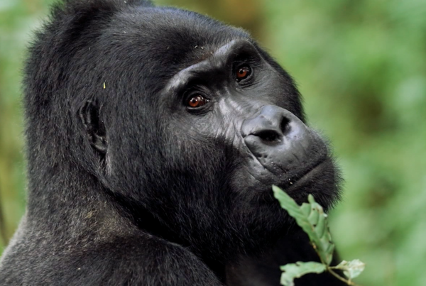
The park’s geography shapes how wildlife uses the forest. Mountain gorillas, for example, move between valleys and ridges depending on food availability and season. Dense vegetation and steep terrain provide cover and security, making Bwindi an ideal refuge for endangered species.
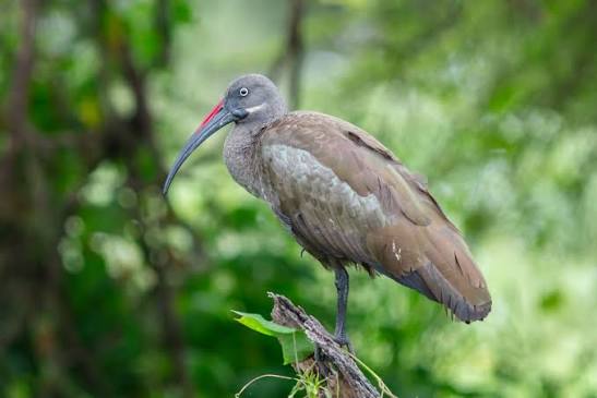
Birdlife is also influenced by geography, with certain species restricted to higher elevations and others favoring valley forests. This vertical separation contributes to Bwindi’s reputation as a premier birding destination.
Human Geography Around Bwindi
Outside the park boundaries, Bwindi’s geography has shaped human settlement patterns. Communities live on steep hillsides and rely on terraced farming to prevent soil loss. Villages cluster along ridges and valleys where access and water are available.
The sharp contrast between cultivated land and protected forest highlights the importance of careful boundary management. Bwindi’s geography makes coexistence between people and wildlife both challenging and essential.
Why Bwindi’s Geography Matters
Bwindi’s geography is not just a backdrop but the foundation of its ecological and conservation value. Its rugged terrain protected it from deforestation, its altitude created unique habitats, and its rivers sustain life year-round. Every aspect of the forest’s biodiversity is tied to its physical landscape.
For visitors, understanding Bwindi’s geography enhances appreciation of the effort involved in trekking and the resilience of life within the forest. The land itself tells the story of why Bwindi still exists today.
Plan Your Safari
Exploring Bwindi is an encounter with geography as much as wildlife. Preparing for steep terrain, altitude changes, and forest conditions ensures a more rewarding experience. When understood and respected, Bwindi’s geography becomes part of what makes a visit to this ancient rainforest unforgettable.
SEO Metadata
SEO Title: Geography of Bwindi Forest – Terrain, Altitude and Albertine Rift Landscape
Meta Description: Explore the geography of Bwindi Impenetrable National Park. Learn about its terrain, altitude range, rivers, soils, and how geography shapes vegetation and wildlife.
Focus Keywords: geography of Bwindi forest, Bwindi terrain, Bwindi Albertine Rift, Bwindi landscape
Slug: geography-of-bwindi-forest
Tags: Bwindi Impenetrable National Park, Bwindi Geography, Albertine Rift, Uganda Rainforest, Gorilla Habitat