Uganda Map & Highlights – A Complete Guide to the Pearl of Africa
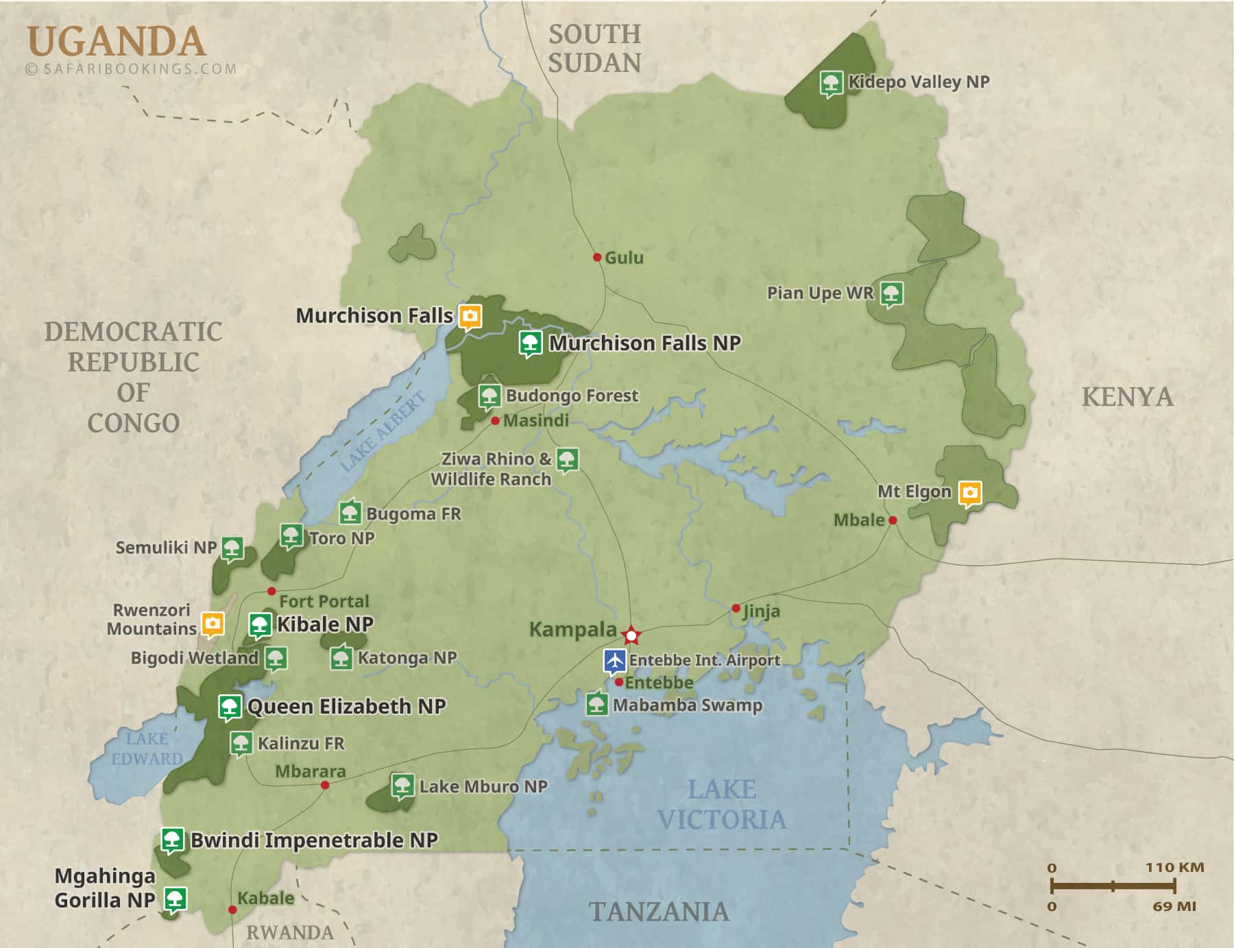
Uganda map. The Pearl of Africa is a landlocked country in East Africa, positioned between Kenya to the east, Tanzania and Rwanda to the south, the Democratic Republic of Congo to the west, and South Sudan to the north. On the map, Uganda sits astride the equator, a factor that strongly shapes its climate, biodiversity, and landscapes. This central location within the Great Lakes region makes Uganda one of the most ecologically diverse countries on the continent.
A glance at the Uganda map immediately reveals its defining features. The country is dominated by water systems, most notably Lake Victoria, which occupies much of the southern border and serves as the primary source of the Nile. The western side of the map is traced by the Albertine Rift, where mountains, rainforests, and national parks cluster tightly together, creating Uganda’s richest wildlife corridor.

Uganda’s Regional Breakdown
Uganda is broadly divided into central, western, eastern, and northern regions, each with distinct characteristics. Central Uganda forms the political and economic heart of the country and includes the capital city, Kampala. This region is densely populated and acts as the main gateway for travelers entering the country.
Western Uganda stands out most clearly on the map due to its concentration of protected areas and dramatic terrain. The eastern region is defined by volcanic landscapes and expansive plains, while northern Uganda opens into savannah and semi-arid zones that feel markedly different from the forested south and west. Together, these regions give Uganda an exceptional variety within a relatively compact area.
Western Uganda – The Wildlife and Primate Heart
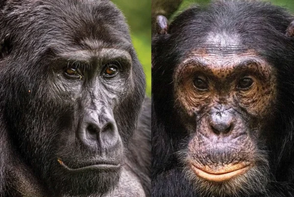
Western Uganda is the country’s primary safari and conservation zone, clearly visible on the map as a chain of parks running along the Albertine Rift. This region hosts Bwindi Impenetrable National Park, globally famous for mountain gorilla trekking. Nearby, Mgahinga Gorilla National Park sits at the foot of the Virunga Volcanoes, offering both gorilla and golden monkey tracking.
The same region also includes Queen Elizabeth National Park, known for its tree-climbing lions, crater lakes, and boat safaris on the Kazinga Channel. Slightly north lies Kibale Forest National Park, home to one of Africa’s highest densities of chimpanzees. On the map, these parks are close enough to allow seamless multi-park itineraries, which is one of Uganda’s greatest strengths.
Eastern Uganda – Mountains and Culture
Mount Elgon, an ancient volcanic massif, dominates eastern Uganda and straddles the border between Uganda and Kenya. The region offers a cooler climate, fertile farmland, and hiking routes that contrast sharply with western Uganda’s rainforests. Caves, waterfalls, and traditional farming communities dot the slopes of Mount Elgon
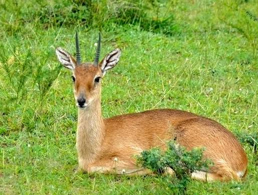
Further east, the map opens into semi-arid plains and wildlife reserves that remain largely unexplored by mainstream tourism. This region provides cultural depth through local communities and traditional lifestyles, making it appealing to travelers interested in slow travel and off-the-beaten-path experiences.
Northern Uganda – Savannah and River Nile Landscapes
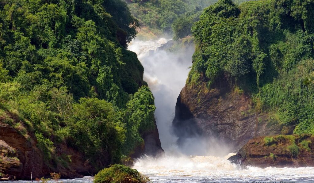
Northern Uganda appears expansive and open on the map, characterized by savannah plains and major river systems. Murchison Falls National Park dominates this region, where the Nile explodes through a narrow gorge before flowing calmly toward Lake Albert. The park combines classic game drives with dramatic river scenery and boat cruises.
Historically less visited, northern Uganda is steadily emerging as a key safari region. Improved infrastructure has made it more accessible, and its wide-open landscapes offer a different rhythm from the forested west, appealing to travelers seeking variety within one country.
Central Uganda – Lakes, Cities, and Cultural Sites
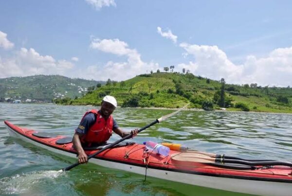
Central Uganda forms the core of the country’s transport and administration network. Entebbe, located on the shores of Lake Victoria, serves as the main international entry point. The surrounding region features rolling hills, islands, wetlands, and cultural landmarks tied to the Buganda Kingdom.
The map also highlights numerous islands scattered across Lake Victoria, some developed for eco-tourism and others remaining largely untouched. This region is ideal for relaxation before or after wildlife-focused travel in other parts of the country.
Uganda’s Key Highlights at a Glance
Uganda’s map tells the story of diversity. Within a single journey, travelers can move from equatorial rainforests to open savannah, from volcanic mountains to Africa’s largest lake. The country stands out for offering mountain gorillas, chimpanzees, classic Big Five safaris, river-based wildlife viewing, and rich cultural encounters in one destination.
Its compact size allows efficient travel between highlights, making it possible to combine multiple experiences without long internal flights. This balance of accessibility and diversity is what continues to position Uganda as one of Africa’s most rewarding safari destinations.
Plan Your Safari
Understanding Uganda’s map is key to planning a successful journey. Each region offers a distinct experience, and thoughtful routing allows travelers to maximize wildlife sightings while minimizing travel time. With careful planning, Uganda delivers a seamless blend of primates, savannah wildlife, landscapes, and culture that few destinations can match.