Best Safari Apps 2026: Wildlife ID, Maps and Travel Tools
How the Right Apps Transform Your Safari Experience
A well-chosen selection of safari apps installed before departure can deepen your wildlife encounter significantly. They help you identify a bird species your guide names in passing, navigate to a waterhole on a self-drive morning, or record your sightings for years after returning home. The key phrase is “well-chosen,” because the app ecosystem for African safari travel has expanded enormously in recent years. It ranges from indispensable field tools used daily by professional wildlife researchers to poorly maintained products that drain battery and require connectivity. These weak apps add clutter to a trip that benefits from focus and presence rather than constant screen attention. The apps below have been evaluated for offline functionality. Essential in remote African parks. Practical field usability, accuracy of their wildlife databases. And whether they add genuine value to the bush experience.
Before any app discussion, the most important practical point is device management. Download all relevant maps, species databases, and offline content before you leave your home country or your last reliable internet connection. In practical terms, this means before you board your final flight or before you depart the gateway city for your first bush camp. Game reserves across East and Southern Africa. Ruaha, South Luangwa, the Okavango Delta, Mana Pools, Mahale. Have no mobile data coverage and often no Wi-Fi. An app that requires an active data connection to function at the moment you most want to use it is worth nothing in those conditions. A portable power bank of at least 20,000mAh capacity is also essential. Camera use, GPS tracking, and app activity across a full safari day will drain a modern smartphone entirely before sundown even if you start with a full charge.
Wildlife Identification Apps
Birds and Mammals
Merlin Bird ID by the Cornell Lab
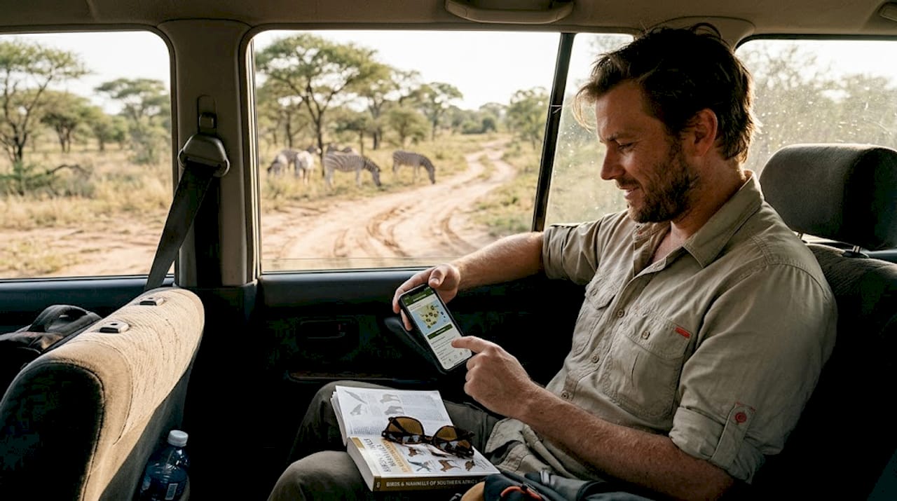
Merlin Bird ID, developed by the Cornell Lab of Ornithology, is arguably the single most valuable wildlife identification tool available to safari travelers and it is completely free. The app uses a combination of visual AI identification from photographs and an extraordinary Sound ID feature. Sound ID listens to ambient bird calls through your phone microphone and identifies species in real time. It displays a running list of every bird calling within range alongside their photographs and range maps. In the field this translates to a transformative experience. Sitting on your lodge deck at dawn and watching the Merlin Sound ID screen populate with the names of twenty bird species calling in the surrounding bush provides immediate ecological context. African fish eagle, lilac-breasted roller, grey-crowned crane, African hoopoe, superb starling. All identified without any bird identification expertise on your part. The Africa species packs cover the entire continent and must be downloaded in advance for offline use. Pack sizes range from 1GB to 3GB depending on the region covered.
The photo identification function in Merlin is particularly useful for safari travelers because it handles a common identification challenge. You have a photograph of an unfamiliar bird taken in poor light from a moving vehicle. And you need to know what it is after the fact. Upload the photograph, crop it to show the bird clearly. And Merlin returns its top three identification suggestions ranked by confidence percentage. It also shows diagnostic field marks that explain why each identification was suggested. The accuracy for African species is impressive but not infallible. The AI performs best on clear, well-lit photographs of perching birds in characteristic posture. It struggles with flight silhouettes, immature plumages, and heavily worn breeding adults in unusual molts. Cross-referencing Merlin’s suggestion against Roberts Bird Guide or a Sasol Birds of Southern Africa entry eliminates the small percentage of confident misidentifications. This process also builds genuine identification skills over time.
iNaturalist for Mammals, Reptiles, and Plants
iNaturalist is the world’s largest community-based biodiversity observation platform. It functions simultaneously as a wildlife identification tool, a personal sighting log, and a contribution to genuine scientific data collection. Wildlife researchers and national parks use it for population monitoring. The app allows you to photograph any organism. Mammal, reptile, insect, plant, fungus, spider. Upload the image with GPS coordinates and date, and receive automated identification suggestions. You also receive community confirmation from the global network of naturalists who review and verify observations in real time. For safari travelers, this means that an unusual lizard photographed sunbathing on a camp rock can be accurately identified within hours of upload. Sometimes it takes only minutes if the observation attracts attention from local Africa-based naturalists who recognize the species immediately.
The offline functionality of iNaturalist has improved significantly with recent updates. You can now record observations including photographs and GPS coordinates without connectivity. The data syncs automatically when you next access the internet in a gateway city or upon return home. This makes it genuinely useful throughout a remote safari itinerary rather than only in areas with Wi-Fi access. The cumulative personal record that iNaturalist builds across multiple safari trips becomes an extraordinary biodiversity journal over time. Every species you have ever photographed and identified is mapped to precise GPS locations and dated, accessible forever through your account. It also contributes to the global scientific understanding of African biodiversity distribution. Many experienced safari travelers describe iNaturalist as the most personally rewarding app they use in the field. It transforms passive wildlife observation into active participation in something that matters beyond their individual trip.
Mammal Field Guides and Sighting Logs
Chamberlain’s Birds of Africa
For Southern Africa safari travelers who want a comprehensive digital field guide to the region’s bird life, the Chamberlain’s Birds of Africa app is the right tool. It provides an extensive database of over 2,000 African bird species with full color plates, range maps, vocalizations, and diagnostic identification text. The content is drawn from the definitive reference works used by professional ornithologists across the region. The app functions fully offline after initial species database download and covers the entire African continent rather than country-specific subsets. This makes it the appropriate tool for multi-country itineraries that cross Southern, East. And Central African boundaries where species composition changes significantly. The vocalization library includes multiple song, call, and alarm vocalization recordings for each species. This is particularly valuable for safari birding because many African forest and thicket species are heard far more often than they are seen. Playing a mystery call against the library entries reveals identity far faster than scanning through visual plates of hundreds of similar-looking small brown birds.
Sighting log apps — specifically Safari Journal or the African wildlife log function within iNaturalist — serve the important function of preserving the detailed record of everything you encounter each day. They do so in a format that survives the inevitable memory compression of a multi-week trip. Safari travelers consistently underestimate how quickly the specific details of individual sightings blur together after returning home. The exact position where the leopard was found, whether the lion cubs seen on day three were with the pride seen on day seven — these details fade. A contemporaneous sighting log entered in the field immediately after each game drive preserves these details with the precision that memory alone cannot maintain across the full duration of a long trip. Logging sightings in real time also allows you to calculate species totals, note behavioral observations. And build a trip record that doubles as a rewarding personal natural history document when re-read during subsequent African winters.
Navigation and Practical Travel Apps
Offline Maps and Travel Logistics
Maps.Me and OsmAnd for Offline Navigation
Maps.Me and OsmAnd both provide fully offline map functionality built on OpenStreetMap data. They cover African national park road networks, camp locations, waterhole positions. And gate access points with a level of detail that Google Maps cannot match in remote areas. Google Maps requires connectivity for detailed African bush coverage. Maps.Me is the more beginner-friendly of the two, with a clean interface and intuitive offline map downloads organized by country and region. You can select and save the specific areas you will visit as easily as downloading a music album. OsmAnd is more powerful and more complex. It offers detailed track logging, offline routing on 4WD tracks, GPS waypoint marking. And a layer system for overlaying satellite imagery, elevation contours, and custom point-of-interest data. Self-drive safari travelers in Namibia, Botswana, and Kruger find these features genuinely invaluable for navigating park road networks and locating specific waterholes.
For self-drive safari travelers, downloading the park map data at the highest available detail level before departure is a critical preparation step. The road networks inside African national parks are far more extensive and branching than any printed park map adequately represents. Kruger’s extensive H-road and S-road system, Etosha’s ring road network. And Namibia’s complex gravel track system through NamibRand and Damaraland all reward a detailed offline map. Being able to zoom in on your offline GPS map at a junction to confirm which track leads to the waterhole you intended to visit saves significant time and fuel. Wrong turns in areas where dead-end tracks can run for 20 kilometers before providing a turning point are costly. Mark your intended campsites, waterholes, and picnic sites as GPS waypoints before entering the park. The navigation challenge of finding specific points within large parks then becomes straightforward rather than stressful.
WhatsApp, Currency Converters, and Health Prep Apps
WhatsApp is the dominant communication platform across all African safari countries. It is the primary tool through which safari operators, lodge reception desks, local guides. And ground transport drivers communicate with guests in real time. Having WhatsApp installed and your operator’s contact number saved before departure means that any schedule change, logistics update, or unexpected situation during your trip reaches you instantly. Most safari operators across East and Southern Africa prefer WhatsApp for all in-destination guest communication. Lodges often create WhatsApp groups for guests arriving together to share transfer logistics and real-time schedule updates. This is not a wildlife app in any sense. However, it is practically the most important communication tool you will carry on any African safari trip. Its absence creates the most operational friction for guests who arrive without it configured.
A reliable offline currency converter. XE Currency is the most widely trusted option. Saves the mental arithmetic required when navigating markets, negotiating curio prices, or calculating tip amounts across multiple African currencies. The app caches the most recently downloaded exchange rates and applies them accurately offline, displaying the conversion result for any amount in any currency pair instantaneously. Health management apps including the Malaria Consortium’s malaria information tools and the IAMAT travel health database provide offline-accessible health and safety information. Government-issued travel advisory apps from your home country. The UK’s Foreign Commonwealth Office app, the US State Department’s STEP app for travel alerts. Supplement your pre-departure travel clinic briefing. They keep you informed about health developments in specific destinations throughout your trip.
Plan Your Safari
African Wild Trekkers sends every guest a detailed pre-departure app guide alongside their itinerary documents, recommending the specific apps most relevant to their destinations, activity types, and interests. Our recommendations are field-tested rather than generic. We know which apps actually work offline in each specific park on your itinerary and which ones promise offline functionality that falls short in practice when you are 300 kilometers from the nearest data signal.
We also share specific data download instructions for each app, recommended offline content to download before departure. And guidance on managing battery life across full safari days. Charging opportunities are limited to lodge and camp facilities during the afternoon rest period. Getting the technology right before you leave home means it supports rather than distracts from your experience in the bush.
Contact African Wild Trekkers at africanwildtrekkers.com/contact with your planned safari destination and we will include a personalized app recommendation list in your pre-departure briefing pack within 24 hours.