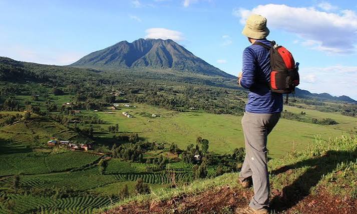
Muhavura Volcano Trek: Reaching the Steep Summit Above the Uganda Border
Muhavura rises to 4,127 metres on the Rwanda-Uganda border. It is the easternmost and most isolated of the accessible Virunga volcanoes. The Muhavura trek is one of the most physically demanding day hikes in the chain. The mountain’s conical shape creates a consistently steep gradient with very little recovery throughout the ascent.
The summit holds a small crater lake. Views extend across the eastern Virunga landscape toward Uganda’s Mgahinga Gorilla National Park directly below. The mountain’s name means “the guide” in Kinyarwanda. Travellers across the open plains have used its shape as a landmark for centuries.
The Summit Ascent
The Muhavura trail starts at the Mgahinga sector at the base of the southern slopes. The first hour passes through lower forest before open moorland begins. From that point, the full steepness of the upper cone becomes apparent. The trail climbs directly up without significant deviation from a vertical line.
There is no easy section on Muhavura. Every hour demands continuous cardiovascular effort at increasing altitude. The sustained steepness sets this hike apart from the others in the Virunga range. Fitness preparation matters more here than on most other East African volcano hikes.
The small crater lake at the summit sits in a perfectly circular caldera bowl. The lake is shallow with photogenic vegetation around its margins. The Uganda volcanoes of Gahinga and Sabyinyo are visible to the west on clear mornings. The view from the summit is wide and rewarding.
Flora and Fauna on the Route
The lower forest sections carry golden monkey habitat. Guides know the forest areas where monkeys range during morning trekking hours. Golden monkey encounters on the Muhavura approach are a genuine possibility.
The Afro-alpine moorland above the treeline is botanically impressive. Giant lobelias and tree groundsels grow to several metres in height. These plants create an otherworldly landscape that surprises first-time visitors. The open moorland is also good habitat for the scarlet-tufted sunbird.
Elephant activity is possible in the forest sections of the approach. The forest corridor between Rwanda and Uganda provides elephant movement routes. Guide knowledge of current elephant positions is part of daily trail safety management.
Practical Details
The Muhavura round trip takes eight to ten hours from the trailhead. An early start is essential to allow comfortable completion before dark. Departing from Kinigi by 7:00 am is strongly recommended.
The summit at 4,127 metres requires serious cold weather preparation. Temperatures at the top can drop below zero in cold season mornings. The exposed cone above the forest offers no shelter from wind. Warm layers, a waterproof jacket, hat, and gloves are all required.
The Muhavura permit is available through the Rwanda Development Board. Availability is generally better than for Bisoke or Karisimbi outside peak season. Combining Muhavura with Sabyinyo on consecutive days from Musanze creates a complete volcano hiking experience.
Plan Your Muhavura Trek
The Muhavura hike works best as part of a multi-volcano Musanze itinerary alongside gorilla trekking. Its eastern position and connection to the Uganda border add geographical context to the Virunga chain. That dimension makes it a worthwhile addition to any serious Rwanda hiking program.
African Wild Trekkers designs Rwanda and Uganda cross-border itineraries that include the Muhavura summit alongside gorilla trekking on both sides of the Virunga ecosystem. Contact us to plan a comprehensive Virunga safari covering both countries.