Kenya Rift Valley Geology: The Earth Tearing Itself Apart
Kenya Rift Valley geology is Africa’s most dramatic tectonic landscape visible from ground level.
The Great East African Rift System created Kenya Rift Valley geology through continental extension beginning 50 million years ago.
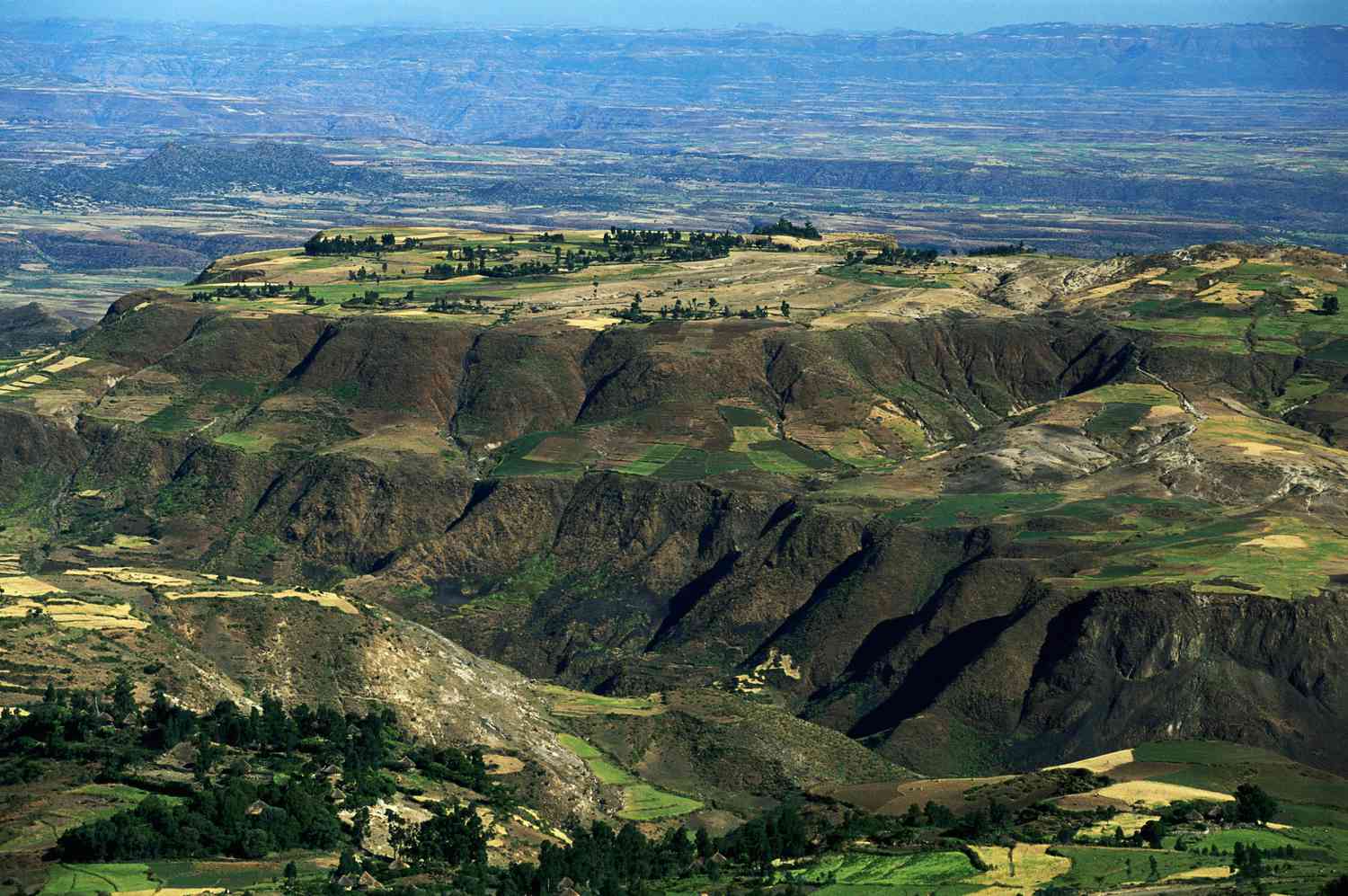
Kenya Rift Valley geology features 1,000-metre escarpments, soda and freshwater lakes, volcanic craters, geysers, and hot springs.
The Great Rift Valley floor drops 600 metres below surrounding plateaus in the most dramatic escarpment sections.
Understanding Kenya Rift Valley geology transforms the Nairobi-to-Nakuru drive into a journey through deep geological time.
Kenya Rift Valley geology is visible from the A104 escarpment viewpoint above Naivasha.
The panorama covers 50 kilometres of the Rift Valley floor.
Kenya Rift Valley geology created the flat valley floor, steep escarpments, and volcanic cones visible from this viewpoint.
The valley lakes collect rainfall and rivers because water cannot reach the sea.
This isolation creates alkaline soda lakes supporting flamingos at Nakuru, Bogoria, and Elementaita.
Kenya Rift Valley Geology Formation
Tectonic Forces Behind Kenya Rift Valley Geology
Kenya Rift Valley geology forms where the Somali Plate separates from the Nubian Plate.
The plates separate by six to seven millimetres annually at monitoring sites.
Stretching of the lithosphere causes the central block to sink, forming the rift valley floor.
Escarpments rise on both sides of the sinking central block.
Graben formation is the fundamental process shaping Kenya Rift Valley geology.
The same geological process continues today.
Eventually, East Africa may separate from the rest of the continent.
Kenya Rift Valley geology spans 50 million years from initial extension to today’s landscape.
Major events included Miocene eruptions forming the Aberdare Range and Mount Kenya.
The Pleistocene brought the region’s most intense volcanic activity.
Longonot, Suswa, and Menengai are geologically young Pleistocene volcanoes.
Geologists classify these volcanoes as dormant rather than extinct.
Volcanoes in Kenya Rift Valley Geology
Mount Longonot is the most accessible Rift Valley volcano for visitors.
This 2,776-metre stratovolcano rises from the Rift Valley floor near Lake Naivasha.
Longonot last erupted about 180 years ago.
The crater rim walk takes about four hours.
The caldera contains secondary volcanic vents and dense forest.
Mount Longonot National Park protects volcanic landscapes and wildlife including giraffe, zebra, and buffalo.
Menengai Crater near Nakuru is Africa’s largest caldera, measuring 12 kilometres across.
The caldera formed after a catastrophic volcanic collapse about 8,000 years ago.
The depression reaches 483 metres deep.
Active fumaroles remain on the crater floor.
Geothermal power plants use underground heat to generate electricity.
Standing on the crater rim reveals the immense scale of Rift Valley volcanism.
Kenya Rift Valley Geology and the Lakes
Soda Lake Chemistry
Kenya Rift Valley geology creates soda lake chemistry through volcanic mineral leaching.
Rainwater dissolves sodium carbonate from volcanic rocks before entering enclosed lakes.
Without river outflows, dissolved minerals accumulate over time.
The lakes reach highly alkaline pH levels between 10 and 11.
These conditions suit spirulina algae but kill most other organisms.
The algae support the region’s famous flamingo populations.
The soda lake ecosystem directly reflects tectonic and volcanic processes.
The lake chain follows the axis of maximum crustal extension.
Each lake occupies its own structural basin within the graben.
>Lake chemistry varies with volcanic rocks and drainage patterns.
>Lake Baringo remains freshwater because basalt contributes fewer sodium minerals.
>Lake Magadi is the most concentrated soda lake.
>Lake Magadi produces commercially mined trona sodium carbonate.
Experiencing Kenya Rift Valley Geology
The A104 escarpment viewpoint above Lake Naivasha offers the best single geological panorama.
Visitors see the Rift Valley stretching 50 kilometres across.
The escarpment drops 600 metres to the valley floor.
Mount Longonot offers a contrasting volcanic experience from its crater rim.
Bogoria’s geyser field showcases active geothermal activity.
Together, these sites explain tectonic, volcanic, and hydrological processes.
Reading geology material at Nairobi National Museum prepares visitors for a Rift Valley circuit.
The museum explains Kenya Rift Valley geology in accessible language.
The British Geological Survey provides detailed Rift Valley maps and cross-sections.
Nairobi bookshops also stock useful geology guidebooks.
One hour of background reading makes every escarpment, volcano, and soda lake easier to understand.
Plan Your Safari
Drive from Nairobi to Nakuru via Naivasha for a complete Rift Valley geology circuit.
Stop at the A104 viewpoint, Mount Longonot, and Menengai Crater.
Add Lake Bogoria’s geysers for the best geothermal experience on the northern circuit.
African Wild Trekkers designs Rift Valley itineraries combining geology, wildlife, and cultural landscapes.
Our programmes include the finest geological viewpoints, volcanoes, and lakes across Kenya’s Rift Valley.
Contact African Wild Trekkers to design a Kenya rift valley geology circuit. We respond within 24 hours and create Rift Valley itineraries where the geological story enriches every lake, volcano, and escarpment viewpoint on your safari.